File:London 2014 routes centre.png
Size of this preview: 733 × 600 pixels. Other resolutions: 293 × 240 pixels | 1,072 × 877 pixels.
Original file (1,072 × 877 pixels, file size: 745 KB, MIME type: image/png)
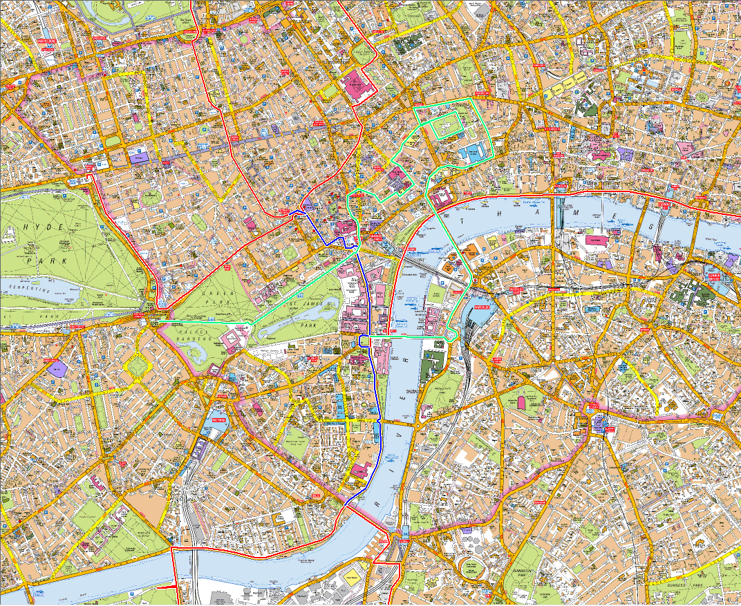
Geographical map of the central London 2014 route, showing more detail about the merged section. This doesn't include the full route from each start point.
File history
Click on a date/time to view the file as it appeared at that time.
| Date/Time | Thumbnail | Dimensions | User | Comment | |
|---|---|---|---|---|---|
| current | 17:14, 13 June 2014 | | 1,072 × 877 (745 KB) | Johnckirk (talk | contribs) | Geographical map of the central London 2014 route, showing more detail about the merged section. This doesn't include the full route from each start point. |
- You cannot overwrite this file.
File usage
There are no pages that link to this file.