File:London 2014 routes all.png
Size of this preview: 395 × 599 pixels. Other resolutions: 158 × 240 pixels | 540 × 819 pixels.
Original file (540 × 819 pixels, file size: 427 KB, MIME type: image/png)
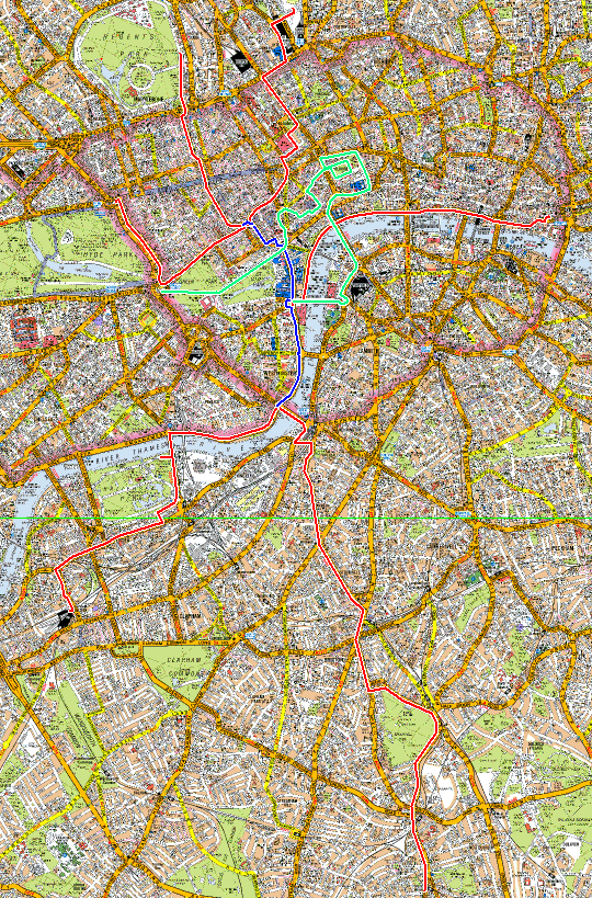
Geographical map of the London 2014 route, showing all 6 start points.
File history
Click on a date/time to view the file as it appeared at that time.
| Date/Time | Thumbnail | Dimensions | User | Comment | |
|---|---|---|---|---|---|
| current | 17:13, 13 June 2014 | | 540 × 819 (427 KB) | Johnckirk (talk | contribs) | Geographical map of the London 2014 route, showing all 6 start points. |
- You cannot overwrite this file.
File usage
There are no pages that link to this file.